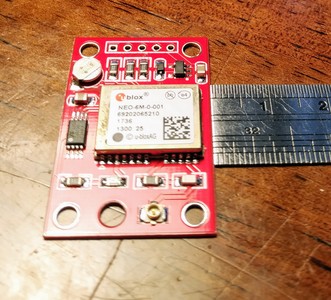
What is its name? So I can take a peek at the datasheet!
I am not sure that it is much use for a robot, my sailing experience and having used GPS a lot is that the best accuracy you can get is about 5 - 10 meters resolution.
The iPhone GPS is actually slightly more accurate because it also taps into the Russian Glonass system, therefore has more satellites to reference.
After a bit of research, my guess is that this a GY-NEO6MV2 NEO-6M.
I still think that the 2.5m resolution shown in the datasheet is a bit optimistic.
But GPS is right up my street. 15 years ago there was very little GPS software for the macOS, and what was available was bloody expensive.
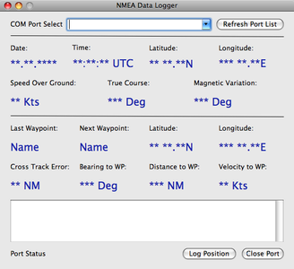
So I wrote my own, as I was doing a lot of single-handed trips, and I needed a position logger so that I could track where I had been. Fix the tiller, flip open the sleeping MacBook Pro, hit the log button, put the Mac back to sleep and return to the cockpit.
And this is what it looked like.
I don't know whether the program works on a newer Mac, I think it was written for a PowerPC chip. ?
It must be the temperature! 30°C plus and no aircon! Mind's turned to mush!
Should have clicked the picture, duh! Then the question would have been totally unnecessary.
It's supposed to be a ublox NEO-6M-0-001, though this one may be a fake. I have a few ublox modules to compare results against. I will solder up some pins soon and test it.
Here is the link from where I purchased: https://www.aliexpress.com/item/32990407585.html?spm=a2g0s.9042311.0.0.292f4c4dcWBQ36
Scott
The one thing I am really interested in is, whether this thing sends out NMEA sentences.
I have still got that old MacBook, so if I connected it to an Arduino, I should be able to read the output into the software I already have!
Before writing some new software for whatever chip the newer Macs use.
If it works, it will be the NMEA text. That does make them so easy to work with! I will test later and let you know how it goes.
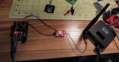
Well, it works. This is from my office window with a small antenna on it and the cat playing with it :/
$GPGGA,999009.00,9999.09484,N,9999.59944,W,1,03,3.61,198.8,M,-32.8,M,,*62
$GPGSA,A,2,07,17,30,,,,,,,,,,3.75,3.61,1.00*05
$GPGSV,2,1,07,07,56,173,30,08,29,048,08,09,00,193,,13,15,301,*7E
$GPGSV,2,2,07,17,28,245,20,30,73,255,32,51,40,221,35*40
$GPGLL,9999.09484,N,9999.59944,W,132009.00,A,A*7C
$GPRMC,132010.00,A,9999.09455,N,9999.59988,W,0.892,,240719,,,A*6B
$GPVTG,,T,,M,0.892,N,1.652,K,A*20
Looks like 7 satellites can be seen if I remember the correct data point for that.
EDIT: Took my coords out. 🙂
Scott,
Is that a baseball pitch?
You just realised what you did!!
I was sitting laughing my nuts off. ?
Well, I knew I did it, I just thought about it for a bit. "No, I do not need any more solicitors." 😉
Yeah, it's the cheapest one I have ever gotten. Am surprised it works.
Going, going, gone!
Just to be fair!
Not exact but close enough!
Stay up for 10 minutes


